 AutoCAD Level 1:
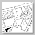
Leans well tested schemes, and is designed to immediately apply learned knowledge and to ensure a complete training path.
Caters to both novice users and those who have a limited knowledge of the software,
and those who need to consolidate an efficient working method.
Users at the end of the course will fully manage the tools that AutoCAD offers
to design in two dimensions, from design to print.
>> Course description in pdf format (formed pdf)
 AutoCAD 3D:
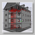
you learn the techniques of design and modeling of solids, surfaces, and three-dimensional objects in AutoCAD.
Particular emphasis is given to the preparation of photographic render, with the application of light, sun and sky, materials,
cameras. The creation of 2D objects is often the first step when users of AutoCAD want to create suitable and detailed three-dimensional shapes,
to represent what they really want to get in AutoCAD. This course is reserved to those who yet manage the use of 2D design in AutoCAD
(for example who has followed AutoCAD Level 1 course).
>> Course description in pdf format (formed pdf)
 AutoCAD Level 2:
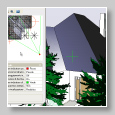
deepen the processing techniques of drawing and symbols in two-dimensional space.
The emphasis is on techniques and tools to work fast and get the best from advanced AutoCAD tools.
A relevant part of the course is dedicated to learn how to standardize the work at the enterprise level,
to optimize the management of projects for both individual users as well as a team.
This course also introduces some basic techniques of three-dimensional drawing
in AutoCAD and basic tools for photorealistic rendering (render).
>> Course description in pdf format (formed pdf)
 Autodesk Map 3D:
The course is intended for users who need to manage information using GIS tools, such as those working
in the geographic information systems and environmental, or entities involved in managing the land.
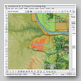
MAP provides the tools to develop the best alphanumeric information related to graphics. The course covers
various techniques to manipulate graphics with powerful CAD tools present in MAP. Particular attention is given
to the procedures for import, export and link data in typical GIS formats (shape files, raster, database, SDF and DGN)
with or without FDO tecnologies.
>> Course description in pdf format (formed pdf)
 Personalized course:
hanks to a free analysis on customer's request, we can propose schemes topics and specific
exercises designed to optimize its activities in AutoCAD. Each course is modeled specifically on customer
requirements. With our support and take advantage of our suggestions and our experience on how to best use
the tools available in specific situations, including corporate figures not engaged in the CAD will make
with us a pattern of going to get the best from their technical AutoCAD results.